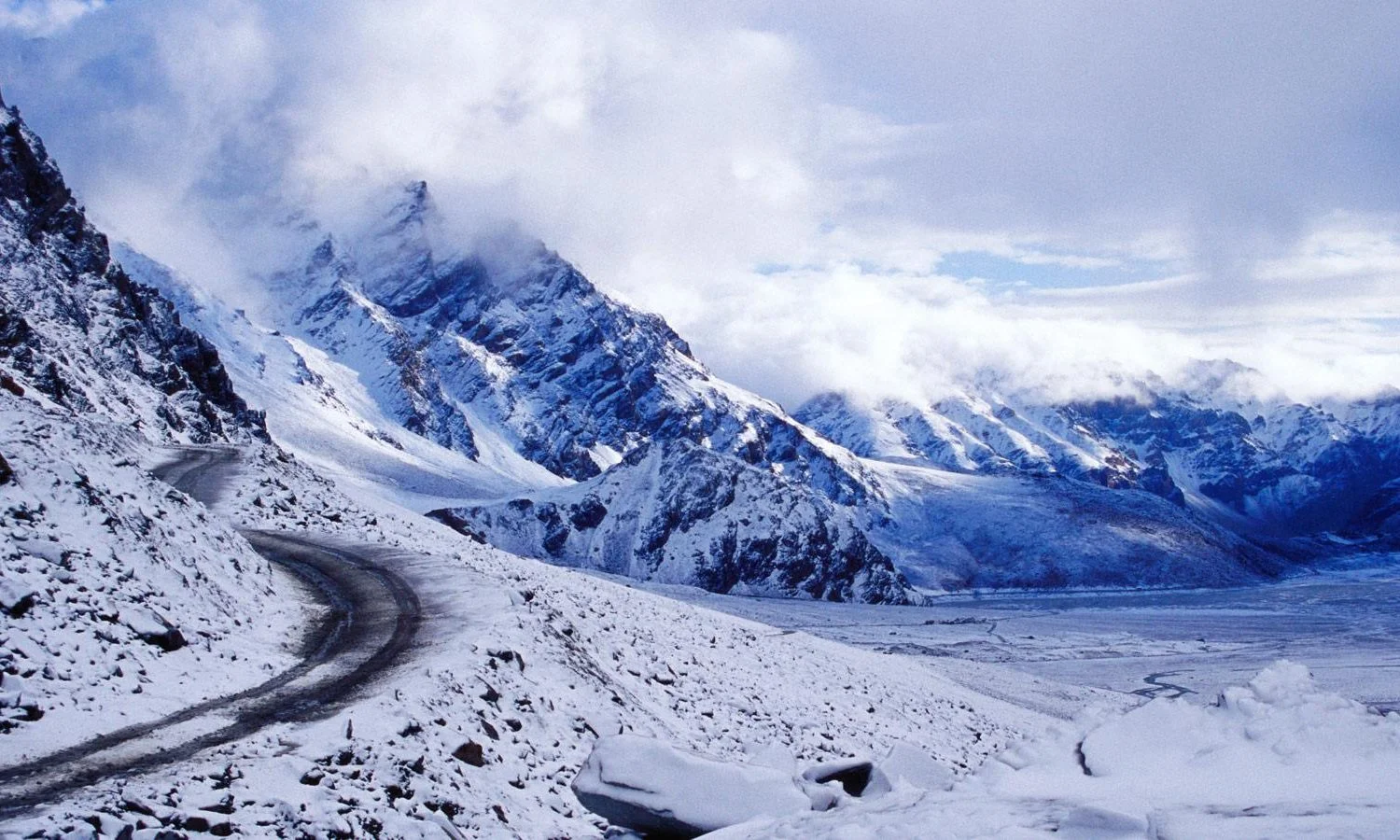


The pass is also a peaceful but powerful landmark. It acts as a water divide between the Chenab and Beas basins, meaning any meltwater will flow down either side of the ridgeline. One side leads into serene rivers flowing through deodar and apple valleys, the other sees the fast moving Chandra River flowing through bleak, rusty mountains. Standing on top of this divide, with every peak snow capped around you, is an amazing feeling, something that can’t quite be captured in photographs. The name Rohtang translates to ‘a pile of corpses’, reflecting the tragic tales of traders, shepherds, and travellers who were stuck in sudden blizzards and hidden crevices. This pass has been one of the major lifelines of the Himalayas for centuries. Salt, wool, dried fruits, and spices were transported between Kullu, Ladakh, Tibet, and Spiti, and the Gaddi shepherds would drive their flocks to the meadows of Lahaul. This pass was also recorded by colonial explorers as one of the most dangerous passes in British India.
This trek is moderately difficult and suitable for people aged between 15 and 55. This makes it a rare opportunity for high altitude trekking. Families, people visiting the Himalayas for the first time, and working professionals can all enjoy this.
Overall, this isn’t really a trek based on how far you’ll travel but more on the ambiance. The crisp air high up at nearly 4000m. The peacefulness of being up high with only the wind and the distant Chandra River to hear. Camping on the banks of a river at Chatru, surrounded by bleak mountains that turn golden in the sunsets. Sitting around a fire, having a hot meal and looking up at the sky filled with stars.
Highlights Of the Trek
1. Standing on the Roof of the Valley at 3,978 m
Reaching Rohtang Pass is the moment everything builds towards. At 3,978 metres (13,058 feet), the Pir Panjal ridges spread out in every direction, with snow-capped peaks cutting against a wide, bright sky. The pass is also the natural water divide between the Chenab and Beas basins, so you are standing on the exact line that decides where the meltwater flows. The air is thin, crisp, and clean, and the silence is broken only by the wind.
2. Two Completely Different Worlds in One Journey
Few routes in Himachal Pradesh show the contrast between two valleys so dramatically. On the Kullu side, the land is green, soft, and wooded. Cross the pass and descend towards Gramphu, and the scenery turns stark: rust-coloured cliffs, bare slopes, and a cold, open desert feel that belongs to Lahaul and Spiti. The change happens within a few hours, and it feels like crossing into another country. For photographers and landscape lovers, this shifting backdrop is the real treasure of the trip.
3. The Rugged Ride Alongside the Chandra River
The stretch from Gramphu to Chatru is the adventurous heart of the trip. The road is unpaved, rough, and wonderfully raw, running right beside the gushing Chandra River as it tumbles through the mountains. There is nothing polished about it, and that is the charm. You feel the terrain, hear the river the whole way, and watch the valley open up around each bend. It is a reminder that this is still genuine mountain country, far from the crowded highway.
4. A Riverside Camp at Chatru
Camping beside the Chandra is easily the most memorable part of the stay. The campsite sits among barren mountains that catch the last gold of sunset, with the sound of flowing water for company. As the cold settles in, the evening revolves around a bonfire, a hot dinner, and easy conversation with fellow trekkers. With no city lights for miles, the night sky fills with stars, making this one of the best stargazing spots you can reach in a short Himalayan break.
5. A Pass Steeped in History, and a Modern Marvel
Rohtang is more than a viewpoint. Its name means “a pile of corpses,” a reminder of the traders, shepherds and travellers who once risked their lives crossing it, and it was a vital link in trans-Himalayan trade between Kullu, Ladakh, Tibet and Spiti. On the way back, you pass through the 9.02 km Atal Tunnel, opened in 2020, and can stop at Sissu Waterfall. Seeing an ancient trade route and one of India’s great modern engineering feats in a single trip adds a rare depth to the experience.
Rohtang Pass Trek Complete Guide
Our mission has always been to ensure that no trekker steps into the Himalayas without the right perspective. A trek is not just a checklist of summits; it is a serious commitment to the outdoors. Having the right information is what separates a reckless climb from a soulful journey.
This section serves as your definitive manual for the Rohtang Pass Trek. We have distilled years of mountain experience and real-time feedback into this guide to give you a clear, honest picture of the trail.
We provide this depth of information because we want you to be more than just a visitor—we want you to be a prepared, responsible trekker who respects the mountains as much as we do.
Day 1: Manali to Chatru via Rohtang Pass
07:30 AM – 09:30 AM: Start from Manali, cross Gulaba and Marhi, and reach Rohtang Pass (3,978 m). (Note: Advance Rohtang permit required).
10:00 AM – 01:00 PM: Descend to Gramphu, have lunch at a local dhaba, and take the rugged off-road route towards Chatru alongside the Chandra River.
02:00 PM Onwards: Arrive at Chatru River Campsite. Spend the evening
enjoying the river view, followed by a bonfire, dinner, and stargazing.
Day 2: Chatru to Manali via Atal Tunnel
08:00 AM – 10:00 AM: Enjoy breakfast at the campsite amidst the mountains and check out.
10:00 AM – 01:00 PM: Drive back via Gramphu toward the Atal Tunnel. Make a quick sightseeing stop at Sissu Waterfall on the way.
Afternoon: Pass through the Atal Tunnel and arrive safely back in Manali.
Day 1
Day 2
Early Morning (7:00 AM – 8:00 AM):
Start your journey early from Manali by hiring a taxi or renting a bike.
Note: To travel through Rohtang Pass, you must book an online Rohtang Permit in advance as it falls under restricted Kullu administration rules.
Morning (9:30 AM – 11:30 AM):
Drive past Marhi and reach Rohtang Pass (3,978 meters / 13,058 ft). Spend some time here enjoying the snow-capped peaks, breathtaking mountain views, and taking photographs.
Lunch Time (12:30 PM – 1:30 PM):
Descend from Rohtang towards Gramphu (the junction where the route splits towards Spiti and Chatru). You can stop at a local dhaba here for lunch.
Afternoon (2:00 PM – 3:30 PM):
The road from Gramphu to Chatru is unpaved, rugged, and adventurous, running right alongside the gushing Chandra River.
Evening (4:00 PM onwards):
Arrive at Chatru and check in to your river campsite.
Spend the evening relaxing by the banks of the Chandra River and watching the sunset over the barren mountains.
Enjoy a cozy bonfire, dinner, and stargazing under the clear night sky.
Morning (8:00 AM – 9:30 AM):
Wake up to the crisp mountain air, enjoy a hot breakfast at the camp, and take in the stunning morning views of the river.
10:00 AM:
Pack your bags and begin your return journey from Chatru.
Return Route:
Instead of going back via Rohtang, head back towards Gramphu and drive towards the Atal Tunnel. The drive through Atal Tunnel is much smoother, faster, and does not require a special permit. You can make a short stop at Sissu waterfall or explore the Lahaul Valley on your way back.
Afternoon (1:00 PM – 2:00 PM):
Cross the Atal Tunnel from the North Portal to the South Portal and head back towards Manali.
Evening:
Arrive back in Manali, concluding your memorable trip.
The Rohtang Pass Trek is a moderate trek that takes place over two days and one night. Whilst it is not particularly long, the trek can be challenging due to the high altitude, cold temperatures, bumpy roads, and camping overnight. This is a great first experience of high-altitude trekking for reasonably fit individuals; however, it should not be taken lightly.
Why it is Moderate
Altitude: The pass is 3,978 m (13,058 ft), and Manali is around 2,050 m. It is a large increase in altitude of nearly 1,900 m over the course of one morning. This is relatively fast for a trek in the Himalayas. Some people will feel a slight headache, shortness of breath, or tiredness.
Bumpy roads: The road from Gramphu to Chatru is not tarmacked and is bumpy. This means you will have a long bumpy day.
Weather: The weather can change quickly at the pass. It can be windy, cloudy and chilly. The nights can be quite cold at your riverside camp.
Campsite: You will be staying in a tent with basic facilities and little electricity or mobile signal.
Experience Needed
No technical skills or trekking experience are required for this trek. You will not need any ropes, crampons, or mountaineering knowledge. However, you will need to be flexible with early starts, long travelling times, basic camping, and respecting the changing mountain weather. This trek can easily be done by those travelling to the Himalayas for the first time if planned sensibly.
This is a seasonal trek with snow covering the road for around 6 months of the year (Nov-April). The trek can only be done during the open months (late spring to early autumn). Depending on what you are looking for, the atmosphere will vary depending on when you go.
1. May-June
This is the most popular time to go. There is still plenty of fresh snow, and the peaks are very dramatic. The days are bright and perfect for sightseeing. However, the nights are cold at the Chatru campsite, so you’ll need warm clothing. This is also the busiest time of the year, so permits can be hard to get. If you are looking for snow and beautiful open views, then this is the best time to go.
2. July-August
This is the most unpredictable time of year. There is often rain and low cloud covering the surrounding peaks of Rohtang and Marhi. The roads can become very slippery, and there can also be landslides on the Manali side. However, the Lahaul side beyond the pass is much drier. This means that the weather can change dramatically once you cross over. However, you will find the slopes very lush and green, and there are fewer people. Plan to be flexible with your dates, pack some rainwear and listen to your trek leader.
3. September
Many travellers consider this to be the best time of year. Once the rain has finished, the air is very fresh and clear. Visibility is great, and the mountains are very defined. The slopes are very autumnal; the nights are cold at camp, but the evenings are beautiful with lots of stars. Photographers will love the consistent light from sunrise to sunset. There are fewer people than during early summer; however, it can be quite cold in the mornings and evenings, so pack some gloves, a woolly hat and a good coat.
Avoid visiting:
November-April
The pass is closed due to heavy snow, and the road access is restricted. It is very cold, snowy, and there is a risk of avalanches, so it is not a good time to go.
To reach Manali for the Rohtang Pass Trek, you have several options depending on your location and preferences. Manali is well connected by road and is accessible from major cities like Delhi and Chandigarh. Here’s a step-by-step guide:
1. By Air
Nearest Airport: Kullu-Manali Airport (Bhuntar Airport), about 50 km from Manali.
Flights Available: Flights from Delhi and Chandigarh to Bhuntar are limited but available. Airlines like Air India and SpiceJet offer flights.
From Airport to Manali: You can hire a taxi or take a local bus from Bhuntar to Manali, which takes about 1.5 to 2 hours.
Pro Tip: Flights to Bhuntar can be expensive and are sometimes canceled due to weather conditions. Plan accordingly or have an alternate option in mind.
2. By Train
Nearest Railway Stations:
Chandigarh Railway Station (310 km from Manali)
Ambala Cantt Railway Station (335 km from Manali)
Since there’s no direct train to Manali, you’ll need to take a train to one of these stations and then travel by road.
From Chandigarh/Ambala to Manali: After reaching either Chandigarh or Ambala, you can hire a taxi or board a bus to Manali. The drive takes around 8 to 10 hours, depending on traffic and road conditions.
3. By Road
Manali is well connected by road and is one of the most popular ways to reach the town.
From Delhi to Manali (about 550 km)
By Bus: Regular overnight Volvo buses run by HRTC and private operators from Delhi ISBT Kashmere Gate. Buses take around 12-14 hours to reach Manali.
By Car: Driving or hiring a cab from Delhi to Manali takes about 12 to 14 hours depending on traffic. Route: Delhi → Chandigarh → Kullu → Manali.
From Chandigarh to Manali (about 310 km)
By Bus: Frequent buses from Chandigarh ISBT to Manali, taking 8 to 10 hours.
By Car: Driving from Chandigarh to Manali takes about 8 to 9 hours.
*Himalayan Hikers will pick you up from Mall Road, Manali, where our team awaits you at 7:00 AM.
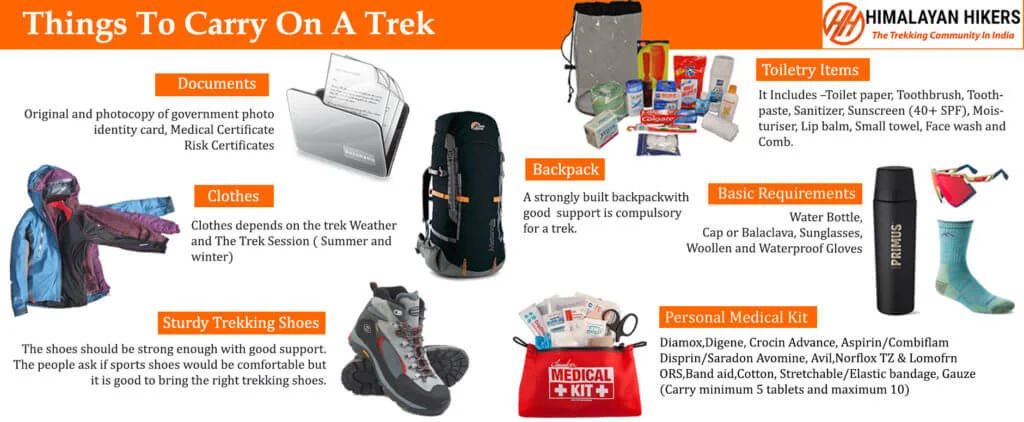
1. Trekking Gear & Bags
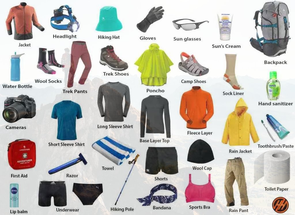
Main Backpack (50–60 Liters): Must have good hip support and a rain cover.
Daypack (20 Liters): Essential if you plan to offload your main bag; carries water, snacks, and a jacket.
Trekking Poles: Highly recommended for stability on snowy slopes.
2. Clothing (The Layering System)
Base Layer (2-3 Pairs): Quick-dry, moisture-wicking thermals (top and bottom).
Mid Layer (2): Fleece jackets or sweaters for insulation.
Outer Layer (2): A high-quality padded down jacket (rated for -10°C).
Trekking Pants (2): Water-resistant and windproof pants. Avoid jeans at all costs.
T-shirts (3): Collared, full-sleeve dry-fit tees to prevent sunburst on the neck.
3. Footwear & Socks
Trekking Boots: High-ankle, waterproof boots with good grip Decathlon Forclaz or similar; MH 100) Asian, Jonmart hiking Shoes.
Woolen Socks (4 Pairs): For sleeping and extra warmth at night.
Cotton Socks (4 Pairs): For trekking during the day.
4. Headwear & Accessories
Sun Cap: To protect against UV rays during the day.
Woolen Cap/Balaclava: Must cover your ears to prevent heat loss.
Neck Warmer/Buff: Protects your face from cold winds.
Gloves: One pair of fleece liners and one pair of waterproof outer gloves.
Sunglasses: Polarized/UV protected to prevent snow blindness.
5. Personal Hygiene & Toiletries
Sunscreen (SPF 50+) and Lip Balm.
Moisturizer and Sanitizer.
Toilet paper and Biodegradable wet wipes.
Toothbrush, Toothpaste, and a small quick-dry towel.
6. Health & First Aid
Personal Medkit: Band-aids, crepe bandage, and antiseptic.
Anti-Altitude Sickness: Diamox (consult your doctor first).
Pain Relief: Volini spray or Moov.
Water Purification: Tablets or a LifeStraw.
Quick Tips for a Successful Trek with Himalayan Hikers
Hydration: Drink at least 3/4 liters of water daily to help with acclimatization.
Batteries: Cold drains phone and camera batteries fast. Keep them inside your sleeping bag at night to keep them warm.
Eco-Friendly: "Pack it in, pack it out." Don't leave any plastic on the trail.
Must-Have Medicines for Beas Kund Trek
1. Altitude & Breathing
Diamox (Acetazolamide): The most common medicine for AMS (Acute Mountain Sickness). It helps your body acclimatize faster.
Note: Start a preventive dose only after consulting your doctor, as it is a diuretic.
Camphor (Kapur): Carrying a small pouch of camphor to smell can help some people feel more comfortable while breathing in thin air.
2. Pain & Inflammation
Combiflam / Ibuprofen: For muscle aches, joint pain, or body fever after a long day of climbing.
Dolo 650 (Paracetamol): For mild fever or headaches (often a first sign of dehydration or AMS).
Diclofenac Gel/Spray (Volini/Moov): Essential for calf muscle cramps or knee pain during the descent.
3. Digestive Health (Very Important)
Digene / Pudin Hara: For acidity or bloating caused by heavy meals at high altitudes.
Ondem (Ondansetron): For nausea or vomiting (common symptoms of altitude sickness).
Eldoper / Nor-Metrogyl: For loose motions or stomach infections.
ORS / Electral: To prevent dehydration. Mix one sachet in your water bottle every day.
4. Respiratory & Cold
Ascoril/Alex Syrup (or Lozenges): For "Khonchi" (dry mountain cough) caused by cold, dry air.
Cetirizine / Okacet: For allergic reactions or a runny nose.
Avomine: If you get motion sickness during the bumpy 8/9-hour drive.
5. First Aid Basics
Band-aids & Cotton: For small nicks.
Crepe Bandage: In case of a minor ankle sprain on the snowy trail.
Betadine/Dettol: Antiseptic for any cuts.
Anti-fungal Powder: To keep your feet dry and prevent fungal infections from wet socks.
Mandatory Document Checklist for Rohtang Pass Trek
1. Government Identity Proof (Original + 2 Photocopies)
You must carry a valid, government-issued photo ID. This is required for forest check-posts.
Accepted: Aadhaar Card, Voter ID, Driver's License, or Passport.
Note: Keep two photocopies handy, as one will be submitted at the Forest Office for your entry permit.
Trek Insurance mandatory
2. Medical Fitness Certificate
Himalayan Hikers prioritizes safety. You cannot start the trek without a certified medical report.
Requirement: The certificate must be signed and stamped by a registered medical practitioner (MBBS Doctor).
Validity: It should usually be issued within 15 to 30 days of the trek start date.
Criteria: It should state that your blood pressure, heart rate, and lung health are normal for high-altitude trekking.
3. Disclaimer & Waiver Form
This is a standard indemnity bond provided by Himalayan Hikers.
What it is: A document stating that you understand the risks of high-altitude trekking and are participating voluntarily.
Process: You can usually download this from our website, sign it, and hand it over at the Base camp.
6-Week Plan specifically tailored for Himalayan Hikers requirements
1. Himalayan Hikers Fitness Benchmark: Rohtang Pass Trek
The climb to Beas Kund has some steep and rocky sections.
The Benchmark: You must be able to cover 5 km in 30 to 32 minutes comfortably.
The Endurance Goal: Since you will walk nearly 20 km over 3 days, leg endurance is more important than raw speed.
2. The 6-Week Training Schedule
Weeks 1-2: The "Foundation" Phase
Running: 3 days a week. Focus on a steady 3 km jog.
Strength:
Squats: 3 sets of 20 (Total 60).
Plank: 2 sets of 45 seconds.
Step-ups: Step up/down for 5 minutes.
Himalayan Hikers Tip: Start increasing your daily water intake to 3 liters to prep your kidneys for altitude.
Weeks 3-4: The "Incline & Endurance" Phase
Running: 4 days a week. Increase distance to 5 km.
Strength:
Walking Lunges: 3 sets of 20 reps. (Crucial for steep sections).
Stair Climbing: Climb up and down 5 floors, 4 times.
Calf Raises: 3 sets of 25. Prevents cramps during descents.
HH Gear Tip: Wear your trekking boots during morning walks once a week to avoid "shoe bites".
Weeks 5-6: The "Summit Ready" Phase
Running: 5 days a week. Target: 5 km in 30 to 33 minutes.
Strength:
Stair Climbing with a Bag: Carry a 5kg backpack for 15 minutes.
High Knees: 3 sets of 1 minute each for lung capacity.
Mental Prep: Practice Pranayama for 10 minutes daily.
Himalayan Hikers Key Points for Fitness
Checkpoint: The HH trek leaders will check your oxygen level. Better fitness improves oxygen saturation.
Monsoon Humidity: Fitness helps your body regulate temperature while you sweat under a poncho.
Knee Care: Squats and lunges are your best insurance against "trekker’s knee."
The Golden Rule: Insist on 4 liters of water daily to keep AMS at bay.
What to Present to the Himalayan Hikers Team?
Fitness App Proof: 4-week history on Strava/Google Fit showing 5km runs.
Medical Certificate: Signed by an MBBS doctor, within 15 days of the trek.
Recovery Note: If you can run 5km today and feel fresh tomorrow, you are "Trek-Fit".
Safety Standards and Expertise
At Himalayan Hikers, your safety is not just a protocol; it is our heritage. With over 35 years of experience, we provide a level of security that no other organisation can.
1. Elite Safety Standards
NIM Certified Leaders: Our trek leaders are certified by the Nehru Institute of Mountaineering (NIM). They are experts in high-altitude rescue and wilderness first aid.
Daily Health Checks: We conduct twice-daily health screenings using Oximeters and BP Monitors to track your oxygen saturation and pulse.
Emergency Oxygen & Kits: Every batch carries portable Oxygen Cylinders and a comprehensive medical kit stocked with essential high-altitude medicines.
Technical Gear: We provide high-quality microspikes (Crampons) for grip on slippery snow and Gaiters to keep snow out of your boots.
2. Premium Accommodation (Hotels & Tents)
High Altitude Camping:We use Premium 4-Season Tents designed to withstand heavy snowfall and bone-chilling winds.
Insulated Bedding: To ensure a warm sleep in -10°C, we provide high-quality sleeping bags rated for extreme temperatures, along with thick foam mats for extra insulation.
3. Reliable Transport Services
Manali to Manali: We provide pickup and drop services from Mall Road, Manali. Safe Mountain Driving: Our drivers are locals who are experts at navigating the winding, snow-covered roads of the Himalayas.
Vehicle Fleet: We use comfortable and well-maintained vehicles like Tempo Travelers and Ertiga taxis, ensuring a smooth journey to the starting point.
4. Nutritious & Fresh Meals
Note: We provide three meals a day, including snacks and soup. A variety of delectable and healthy food is provided, which includes Indian, Chinese, and other Western meals. They are nutritious and keep you fit and healthy on the trek (veg food). Daily fruits keep your energy levels high. Hygiene First: Our kitchen staff follows strict hygiene standards, ensuring clean drinking water (boiled/filtered) at all campsites.
No inclusions found.
No exclusions found.
Note: Please bring your own lunch box for the hot lunch.
Emergency evacuations and Hospitalization charges Extra
Important Note
No important note.
Map not available for this trek.
The trek is a 2-day, 1-night journey from Manali to Manali. You head out early on day one, cross the pass, camp overnight at Chatru, and return to Manali on day two.
Rohtang Pass sits at 3,978 metres (13,058 feet) in the Pir Panjal range, about 51 km from Manali. It is the highest point of the trip.
It is rated moderate. No technical skills are needed, and the challenge comes from the quick gain in altitude, cold weather, rough roads, and a night in camp. Reasonable general fitness is enough.
May to June is ideal for snow and dramatic views, and September offers clear skies and sharp visibility. July and August bring monsoon rain and clouds. The pass is snow-bound from roughly November to April, so it is not open for the trek in those months.
Yes. Entry to the pass is regulated, and an advance Rohtang permit is required for travel across it. Access is controlled by daily quotas to protect the fragile alpine environment, so arrange your permit well before your travel date. The return route through the Atal Tunnel does not need a special permit.
The trek is suitable for ages 15 to 55 and works well for first-time Himalayan travellers, families and working professionals. If you have heart, breathing or blood pressure concerns, check with your doctor before booking.
You spend the night in a camp at Chatru, beside the Chandra River. The evening includes a bonfire, dinner, and stargazing.
On day two, you head back via Gramphu and pass through the 9.02 km Atal Tunnel, which bypasses Rohtang Pass. The route is smoother and faster, and there is a short stop at Sissu Waterfall on the way to Manali.
It can be for some people, since you reach nearly 4,000 m within a few hours of leaving Manali. Drink plenty of water, move at a relaxed pace, avoid alcohol, and tell your trek leader at once if you feel a persistent headache, nausea, or dizziness. Descending towards Chatru usually brings relief.
Carry a valid government photo ID, warm layers, a windproof and waterproof jacket, gloves, a woollen cap, sunglasses, sunscreen, comfortable trekking shoes and a small personal medical kit. Nights at camp are cold even in summer.