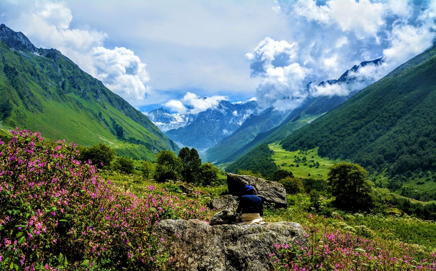


The Valley was totally unknown to the world until 1931, when a British mountaineer, Frank S Smythe, and his team lost their way and found this valley by accident. Overwhelmed by its beauty, they named it the “Valley of Flowers,” and the magic of this place hasn’t changed since, making it The Most Popular Monsoon Trek in Uttarakhand Himalayas.
Think of the days when your eyes were glued to one of The Most Charming Valley of Uttarakhand, India during the monsoon season. The will literally rejuvenate your soul and you will reminisce about your journey.
The valley not only welcomes you with flowers but on the way get to witness a huge gorge and small streams flowing by. After hours of laborious trekking, your heart will skip a beat, and the enthusiasm is “Electrifying Boom” there goes the vast endless drop-dead gorgeous, exquisite valley. The feeling will be so compelling and sensational. This will remind of those hours how one has struggled to come here just to witness this magic which can melt anyone’s heart.
All About The Trek – A UNESCO World Heritage Site
A few hours of trekking would be slightly difficult, but once you reach the valley you will forget about everything. Enjoy the tranquility and the hush around the valley. Watch the rise of the moon around Midnight, ogled at the stars shimmering millions of light-years away with your friends and family by lying inside the tent. Get to see the different kinds of flowers. This would be a treat to your eyes, as you witness the different types of Himalayan flowers.
It has gained so much importance and is adorned with a diversity of Alpine flowers, representative of the Western Himalayan Alpine shrub and meadow ecoregion.
The valley is also blessed with various colors of Flowers, taking on diverse shades of colors as time advanced. Brahma Kamal is one of the most famous. Himalayan flower which can be seen in the month of July- August.
UNESCO World Heritage Criteria & Significance
The National Park (Uttarakhand, India) is a UNESCO World Heritage Site known for its “breath-takingly beautiful meadows of alpine flowers” and outstanding scenic value. Nestled in the high Himalaya, the park’s rolling flower-strewn meadows and verdant slopes lie alongside the rugged Nanda Devi mountains, together forming a unique transition zone between the Zanskar and Great Himalayan ranges.
This dramatic landscape has long attracted explorers, botanists and pilgrims, and even features in Hindu mythology (often called Indra’s “Flower Garden”), reflecting its cultural resonance.
In UNESCO’s words, “renowned for its meadows of endemic alpine flowers and outstanding natural beauty”, a reputation dating back over a century.
Outstanding Natural Beauty (UNESCO Criterion VII)
UNESCO inscribed under natural criterion VII for its exceptional aesthetic value. The park’s high-altitude valley floor is covered each summer in vast carpets of wildflowers – primulas, poppies, primulas and hundreds more – set against snow-capped peaks. Evaluations note the valley’s “breath-takingly beautiful meadows of alpine flowers” and “gentle landscape” as a striking contrast to the towering peaks of neighboring Nanda Devi.
Mountaineers and botanists have described it as “an outstandingly beautiful high-altitude Himalayan valley”, celebrated in travelogues and folklore. In short, the park’s scenic splendor and flower-filled vistas are UNESCO-listed for their superlative beauty and visual grandeur.
This Valley is also noted under criterion X for its exceptional biodiversity. Botanists have recorded over 600 species of flowering plants in the valley (about 25% of all vascular plants in the region) despite its small area. Many of these are rare, endemic or even globally threatened (for example Meconopsis aculeata – the blue Himalayan poppy, and several Saussurea species). The park was in fact “the first protected area in India designated specifically for its flora”.
Besides healthy plant growth, the meadows and forests of the alpine region support threatened wildlife UNICEF very rightly cites the snow leopard, blue sheep (bharal), Asiatic black bear, Himalayan brown bear, and Himalayan musk deer as examples found in the Valley. All in all, the unique alpine flora found in the Valley and its status as a refuge for endangered fauna of the Himalayas justify its world significance for biodiversity.
- Flora: 600 species of high-altitude plants, including many endemics and medicinal herbs
- Fauna: Important populations of threatened mammals (snow leopard, musk deer, Himalayan bears, blue sheep) and numerous birds.
- Botanical importance: The site is recognized as a Centre of Plant Diversity and supports a wealth of rare alpine herbs.
High-Altitude Ecological Transition Zone
The NP sits at the junction of two great Himalayan sub-ranges. To the north lie the Zanskar Mountains and to the south the Great Himalaya; similarly, its flora blends elements of both Eastern and Western Himalayan plant zones. This “ecological transition zone” enhances species richness: plants from different biogeographic regions coexist here. Many plant species are found nowhere else in India, and two recorded in the valley were previously unreported even from Nanda Devi NP.
In effect, the Valley’s location gives it an unusually rich assemblage of alpine flora and fauna, further justifying its protected status.
Cultural & Historical Context
Beyond nature, the valley has cultural and historical significance. In local Hindu lore it is sometimes called Nandan Kanan (the “Garden of Indra”), reputedly strewn with flowers by the gods. Early explorers and botanists – from Frank Smythe to Lady Legge and Indian scientists – chronicled its wonders. UNESCO’s evaluation explicitly notes the area’s praise “in Hindu mythology” and its long acclaim by “renowned mountaineers and botanists”.
In other words, the site has been celebrated in both traditional culture and scientific literature for its serene beauty and floral wealth, adding intangible heritage value alongside its ecological importance.
UNESCO Listing and Conservation Status
The Valley of Flowers (together with Nanda Devi NP) was inscribed as a UNESCO World Heritage Site in 1988 (Nanda Devi alone) and extended in 2005 to include the Valley. It is listed under natural criteria (vii) and (x) – highlighting both its superlative beauty and biodiversity. The core protected area spans approximately 8,750 hectares, forming part of a larger 71,210-hectare combined property.
Importantly, both parks form the heart of the Nanda Devi Biosphere Reserve.
The Valley was made a core zone of this reserve in 2000, and UNESCO added the entire reserve (including both parks) to its Man and Biosphere network in 2004. These designations mean that the site is protected under several international conservation mandates. In reality, strict protection, regulated tourism and the community utilization of resources work to guarantee the fragile alpine ecosystems of the valley remain preserved.
UNESCO’s designation now recognizes the global ecological important facilitates that its endemic flowering plants and rare animals will be preserved for future generations.
Top Reasons to Choose Valley of Flowers Trek
This is an Indian National Park, located in the Chamoli district, in the state of Uttarakhand. Before heading towards the itinerary, it is really essential to perceive the reason behind choosing this location. At an altitude of around 12,140 feet (3,700 meters), this trek offers stunning Himalayan views without being overly strenuous.
That’s why it’s such a great choice for families, students, or anyone who’s just starting out with trekking. But what truly sets this place apart is that it’s not just beautiful—it’s also recognized worldwide as a UNESCO World Heritage Site.
The National Park spreads over 87 square kilometers, filled with wildflowers, rare plants, and fresh mountain air. If you go during the monsoon season, you’ll see the entire valley covered in flowers of every color. It honestly feels like walking through a dream.
First of all, the Trekking Distance is a total of 568 Km by taxi and on foot 42 km which is to be covered for 5 nights 6 days. This is the best trek for families, Students, and Beginners, Altitudes is 12140 feet – (3700 Meters).
Not Just a Trek, But a Walk Through Heaven
This isn’t just a hike — it’s an emotion. Nestled in Uttarakhand’s Chamoli district, the National Park is more than a destination. It’s where rare Himalayan flora bloom with stories, where monks once meditated, and where clouds come down to greet you. Recognized as a UNESCO World Heritage Site, this moderate-level trek is ideal for first-timers and dreamers alike.
Whether you’re a botany enthusiast, a peace-seeker, or just someone trying to escape city noise — this trek stays with you, long after your boots are off.
Most Popular Flowers Found in Valley
The National Park is home to a diverse range of Himalayan alpine flowers. Some of the most stunning and rare blooms you’ll find here include:
- Blue Poppy (Meconopsis Aculeata) – The iconic and rare Himalayan Blue Poppy
- Brahma Kamal (Saussurea Obvallata) – A sacred flower found at high altitudes
- Cobra Lily (Arisaema) – A unique, snake-like flower
- Marsh Marigold (Caltha Palustris) – Bright yellow flowers covering wetland areas
- Primula (Primrose) – Vibrant purple, pink, and yellow blossoms
- Daisies & Anemones – Carpet-like floral spread across the valley
- Rhododendrons – Stunning red and pink blooms in the forests
- Best Time to See Flowers: July to September
- Location: UNESCO-listed Valley of Flowers National Park, Uttarakhand
Why is This Trek So Unique?
Tucked away in the high reaches of Uttarakhand’s Chamoli district, they feels like something straight out of a dream. But beyond its postcard beauty, this Himalayan wonderland holds a lot more than meets the eye — it’s a place where science and nature quietly work hand in hand.
Trek to Hemkund Sahib – The Highest Sikh Temple (4,160m)
Shri Hemkund Sahib is a place of faith and belief where you will feel peace of mind, which today formally known as Gurdwara Shri Hemkund Sahib Ji, this place There is a Sikh Gurdwara in Chamoli district of Uttarakhand, India, where people come for their worship and faith and worship wholeheartedly and is a place of pilgrimage.
This Gurdwara is dedicated to the tenth Sikh Guru, Guru Gobind Singh (1666–1708), and the place finds mention in the Dasam Granth, directed by Guruji himself, where mythological components are present in the work.
According to the Survey of India, situated at an altitude of 4,160 meters in the Himalayas, is a glacial lake surrounded by seven Himalayan mountain peaks, each adorned with a Nishan Sahib on its rock. It is approached from Govindghat on the Badrinath Highway. It is at a distance of about 19 kms from Govindghat. The nearest main town is Joshimath.
The elevation of the lake at Hemkund is about 4,160 m. You can get a 360-degree view from Hemkund Sahib. Its distance from Ghangaria Base Camp is 6 kilometers on one side, it is about 12 kilometers on both sides.
It is said that for those who go here to ask for something from their heart, their every wish is fulfilled. Going to Hemkund Sahib is also very special because here you also get to see flowers like Brahmakamal and Fankamal. You can find these flowers only in a place at an altitude of 13000 feet. above
Valley of Flowers Trek Complete Guide
Our mission has always been to ensure that no trekker steps into the Himalayas without the right perspective. A trek is not just a checklist of summits; it is a serious commitment to the outdoors. Having the right information is what separates a reckless climb from a soulful journey.
This section serves as your definitive manual for the Valley of Flowers Trek. We have distilled years of mountain experience and real-time feedback into this guide to give you a clear, honest picture of the trail.
We provide this depth of information because we want you to be more than just a visitor—we want you to be a prepared, responsible trekker who respects the mountains as much as we do.
Day 1– Pickup to you from Dehradun Railway Station Drive to Govind Ghat via Rishikesh Devprayag, Rudraprayag, Joshimath (288 Km) (10/11 Hours) (1,875 m/ 6152 feet), Overnight Stay Hotel (Mode of transport by Tempo Travellers & Ertiga Taxi )
Day 2– After Breakfast Drive from Govindghat to Pulna by Local taxi (05 km -30 minutes drive), same day trek to Ghangaria (09 km) (5/6 Hours) (Altitude –10101 feet) Overnight Stay Hotel
Day 3– Trek from Ghangaria to Valley of flowers (10 km) Both Way (7/8 Hours) Altitude – 12140 feet back to Ghangaria Hotel-Overnight Stay Hotel
Day 4– Trek from Ghangaria to Hemkund Sahib (12 km) Both way (7/8 Hours) 14,100 feet) back to Hotel Overnight Stay Hotel
Day 5– Trek from Ghangaria to pulna road head 9 km /4/5 hours ) Same day driver to govind Ghat by local taxi (05km) 30 minutes)- After lunch if you intrested to visit Badrinath dham then take sharing taxi or tempo visit to Badrinath after darshan back to Hotel Govindghat – Overnight Stay Hotel
Note- Badrinath Sharing costs Rs. 500.00 both way per person pay to Directly your Driver
Day 6– Drive from Govindghat to Dehradun via Rishikesh by Taxi (288 km) (10/11 Hours) reach in the evening 7:00 pm. to 8:00 pm Dehradun Railway Station ((Mode of transport by Tempo Travellers & Ertiga Taxi )
Day 1
Day 2
Day 3
Day 4
Day 5
Day 6
Day 1 : Pickup from Dehradun Railway Station 6:00 am or Rishikesh Welina Shree Hotel Tapovan 7:00 am and Drive to Govidghat (base camp) by Tempo Travllers
- Total distance – 288 km – 10/11 Hours journey
- Mode of journey – By Tempo Travellers
- Altitude – Govindghat– 6152 feet
- Night stay – Hotel – Share basis 3/4 trekkers per room
Himalayan Hikers organizes transport for trekkers from Dehradun Railway Station in the morning which will leave for Govindghat around 6:00 am to 6:30 am.
The drive from either Dehradun Railway Station via Rishikesh to Govindghat , serving as the base camp for various treks and pilgrimage sites in Uttarakhand, offers spectacular views of the Himalayan landscape, river valleys, and quaint mountain villages. Here’s what you can expect along the route:
- Departure from Dehradun or Rishikesh: Your journey begins in either Dehradun or Rishikesh, both of which are major towns in Uttarakhand and significant pilgrimage destinations. These towns are located on the banks of the Ganges River and offer a spiritual atmosphere with numerous temples, ghats, and ashrams.
- Travel along the Ganges River: As you leave Haridwar or Rishikesh, you’ll travel alongside the Ganges River for a significant portion of the journey. The river is a lifeline for the region, and you’ll witness locals engaging in various activities along its banks, from performing rituals to taking dips in its holy waters.
- Ascend into the Mountains: As you proceed towards Joshimath, you’ll gradually ascend into the Garhwal Himalayas. The road winds its way through dense forests, providing glimpses of towering peaks and cascading waterfalls. Keep an eye out for the diverse flora and fauna that inhabit the region, including Himalayan birds and wildlife.
- Crossing Confluence Points: Along the route, you may pass several confluence points where rivers merge. One notable confluence is Devprayag, where the Alaknanda River and Bhagirathi River meet to form the Ganges. These confluence points hold religious significance and offer stunning views of the merging rivers against the backdrop of the mountains.
- Scenic Villages and Towns: En route to Joshimath, you’ll pass through charming mountain villages and towns nestled amidst terraced fields and orchards. These villages offer a glimpse into the traditional lifestyle of the local Garhwali people and provide opportunities to interact with the friendly locals.
- Views of Nanda Devi Peak: On clear days, you may be treated to panoramic views of the majestic Nanda Devi Peak, which is the second highest mountain in India. The snow-capped peaks of the Nanda Devi range dominate the skyline and add to the beauty of the journey.
Day 2 : Drive from Govindghat to Pulna by Local taxi (05 km -30 minutes drive ,same day trek to Ghangaria
- Total distance – 09 km – 5/6 Hours journey
- Mode of journey – On foot
- Altitude Ghangaria – 10,101 feet
- Night Stay – Hotel – Share basis 3/4 trekkers per room
The trek from Govindghat to Ghangaria is part of the famous Valley of Flowers trek and the pilgrimage route to Hemkund Sahib in Uttarakhand, India. Here’s what you can expect along the trek route and the difficulty level:
- Trek Route: The trek from Govindghat Pulna Road head to Ghangaria covers a distance of approximately 09 kilometers. It follows a well-defined trail that ascends gradually along the Pushpawati River valley. The route passes through dense forests, charming mountain villages, and scenic meadows. Along the way, you’ll cross several suspension bridges over the river and encounter waterfalls, streams, and occasional grazing grounds.
- Difficulty Level: The trek from Govindghat to Ghangaria is considered to be of moderate . While the trail is well-marked and maintained, it involves a continuous ascent, which can be strenuous for some trekkers, especially if they are not accustomed to high-altitude hiking. The altitude gain from Govindghat (approximately 1,800 meters) to Ghangaria (approximately 3,050 meters) is significant, so it’s essential to pace yourself and take regular breaks to acclimatize.
- Terrain: The terrain along the trek route varies from rocky paths to dirt trails and wooden bridges. There are some sections with steep ascents, particularly as you approach Ghangaria. Additionally, depending on the time of year, you may encounter snow patches, especially in early summer months. Proper footwear with good grip is essential to navigate the terrain safely.
- Duration: The trek from Govindghat to Ghangaria typically takes around 6/7 hours to complete, depending on your pace and fitness level. It’s advisable to start early in the day to avoid hiking during the hottest hours and to allow plenty of time for rest breaks and enjoying the scenery along the way.
- Scenic Views: Despite the physical exertion, the trek offers breathtaking views of the surrounding mountains, including glimpses of towering peaks such as Neelkanth and Hathi Parvat. The lush greenery of the valley, dotted with colorful flowers during the monsoon season, adds to the beauty of the trek.
Day 3 : Trek from Ghangaria to Valley of flowers
- Trek Distance – 10 km – 7/8 Hours journey
- Mode of journey – On foot
- Altitude – Valley of flowers – 12,140 feet
- Night Stay – Hotel -on Share basis 3/4 trekkers one Room
Today, you will be trekking to a World Heritage Site and National Park of Flowers. Post breakfast leave with packed lunch Ghangaria and come across the entry gate of the valley of flowers national park.
The trek from Ghangaria to the Valley of Flowers is the highlight of the Valley of Flowers trek in Uttarakhand, India. Here’s what you can expect along the route and the moderate level:
- Trek Route: The trek from Ghangaria to the Valley of Flowers covers a distance of approximately 04 to 5 kilometers one way. It follows a well-defined trail that ascends gradually through the valley. The route initially passes through forests and then opens up to the alpine meadows of the Valley of Flowers. Along the way, you’ll encounter numerous streams, waterfalls, and vibrant patches of wildflowers.
- Difficulty Level: The trek from Ghangaria to the Valley of Flowers is considered to be of moderate difficulty. While the trail is relatively short, it involves some steep sections and uneven terrain, particularly as you approach the valley. Additionally, the altitude gain from Ghangaria (approximately 3,050 meters) to the Valley of Flowers (approximately 3,600 meters) may cause breathlessness and fatigue, especially for those not acclimatized to high altitudes.
- Terrain: The terrain along the trek route consists of rocky paths, dirt trails, and wooden bridges. There are some sections with steep ascents and descents, as well as narrow passages. Proper footwear with good grip is essential to navigate the terrain safely, especially if the trail is wet or slippery due to rain or snowmelt.
- Duration: The trek from Ghangaria to the Valley of Flowers typically takes around 1.5 to 2 hours to complete one way, depending on your pace and the time spent exploring the valley. It’s advisable to start early in the day to avoid hiking during the hottest hours and to allow plenty of time for enjoying the scenery and photography opportunities in the valley.
- Scenic Views: The Valley of Flowers is renowned for its stunning natural beauty, with a kaleidoscope of colorful flowers carpeting the landscape during the monsoon season. As you trek through the valley, you’ll be surrounded by panoramic views of snow-capped peaks, lush greenery, and a myriad of flowers, including orchids, poppies, primulas, and more.
Day 4 : Trek from Ghangaria to Hemkund Sahib 14,100 feet) back to Hotel
- Trek Distance – 12 km – 7/8 Hours journey
- Mode of journey – On foot
- Altitude – Hemkund Sahib Ji – 14,100feet
- Night Stay – Hotel – share Basis 3/4 trekkers one Room
The trek from Ghangaria to Hemkund Sahib is a challenging yet spiritually rewarding journey in the Uttarakhand region of India. Here’s what you can expect along the route and the difficulty level:
- Trek Route: The trek from Ghangaria to Hemkund Sahib covers a distance of approximately 06 kilometers one way. It is a steep ascent that gains altitude rapidly. The trail begins from Ghangaria and winds its way up the mountainside, passing through a series of switchbacks and stone-paved paths. As you ascend, you’ll pass through dense forests of pine and rhododendron, eventually reaching the alpine meadows and glacial landscapes near Hemkund Sahib.
- Difficulty Level: The trek from Ghangaria to Hemkund Sahib is considered to be of moderate to strenuous difficulty. The steep and continuous ascent, coupled with the high altitude, makes it challenging for many trekkers. The altitude gain from Ghangaria (approximately 3,050 meters) to Hemkund Sahib (approximately 4,300 meters) is significant and may cause symptoms of altitude sickness, such as shortness of breath, headache, and fatigue.
- Terrain: The terrain along the trek route consists of rocky paths, uneven terrain, and stone steps. There are sections with steep inclines, particularly in the latter part of the trek as you approach Hemkund Sahib. The trail can be slippery, especially if it has rained or snowed recently, so sturdy hiking boots with good grip are essential. Additionally, trekkers should be cautious while crossing streams and navigating narrow passages.
- Duration: The trek from Ghangaria to Hemkund Sahib typically takes around 3 to 4 hours to complete one way, depending on your pace and acclimatization. It’s advisable to start early in the day to avoid hiking during the hottest hours and to allow plenty of time for rest breaks and acclimatization stops. Trekkers should listen to their bodies and take breaks as needed to prevent altitude sickness and exhaustion.
- Scenic Views: Along the trek route, you’ll be treated to breathtaking views of the surrounding mountains, valleys, and waterfalls. As you ascend higher, the landscape transforms into alpine meadows dotted with colorful wildflowers during the summer months. The final stretch to Hemkund Sahib offers panoramic views of the glacial lake and the surrounding peaks, creating a serene and awe-inspiring atmosphere.
Day 5 : Trek from Ghangaria to Pulna Road head (09km) (4/5 hours)same day Drive to Govind Ghat Hotel (05km)
- Trek Distance – 09 km – 5/6 Hours journey (Drive 05 km) 20 minutes
- Mode of journey – On foot
- Night Stay – Hotel – share basis 3/4 Trekkers one Room
Trek from Ghangaria to Govind Ghat (9 kilometers): The trek from Ghangaria to Govind Ghat covers a distance of approximately 9 kilometers. It’s a descent from Ghangaria to Govind Ghat, so the terrain is generally easier than the ascent. The trail follows a well-marked path, and you’ll pass through the scenic landscapes of the valley, including forests, streams, and meadows. Depending on your pace, the trek can take around 3 to 4 hours to complete.
After lunch if you intrested to visit Badrinath dham then take sharing taxi or tempo visit to Badrinath after darshan back to Hotel Govindghat – Overnight Stay Hotel
Note- Badrinath Sharing costs Rs. 500.00 both way per person pay to Directly your Driver
Day 6 : Drive from Govindghat to Dehradun Railway Station via Rishikesh by Tempo Travellers
- Trek Distance –288 km – 10/11 Hours journey
- Mode of journey – By Tempo travellers
The drive from Govidghat to Dehradun via Rishikesh by Tempo Traveller offers stunning views of the Himalayan landscapes, river valleys, and charming towns along the way. Here’s what you can expect during the journey:
- Departure from Govindghat : Your journey begins in Govindghat , a bustling town located in the Chamoli district of Uttarakhand.
- Travel through the Garhwal Himalayas: As you leave Joshimath, you’ll travel through the Garhwal Himalayas, passing through picturesque mountain villages and dense forests. The road winds its way down the mountainsides, offering panoramic views of snow-capped peaks and verdant valleys.
- Passing through Chamoli and Rudraprayag: Along the route, you’ll pass through the towns of Chamoli and Rudraprayag, which are located at the confluence of rivers. These towns are known for their scenic beauty and spiritual significance, with numerous temples and shrines dotting the landscape.
- Arrival in Rishikesh: After descending from the mountains, you’ll arrive in Rishikesh, a vibrant town situated on the banks of the Ganges River. Rishikesh is renowned as the “Yoga Capital of the World” and attracts visitors from around the globe for its spiritual ambiance, ashrams, and adventure activities such as rafting and trekking.
- Continuation to Dehradun : After your spiritual immersion in Rishikesh, your journey continues to Dehradun, the scenic capital of Uttarakhand nestled in the foothills of the Himalayas. Known for its pleasant climate and colonial charm, Dehradun offers a more relaxed, urban-mountain vibe compared to the intense energy of the ghats.
Dehradun between 7:00 PM and 8:00 PM, depending on traffic at the Rajaji National Park stretch.
Difficulty Level of Valley of Flower Trek
The altitude of the trek ranges from 3,858 meters to 4,572 meters, which is a stunning trek in the Indian Himalayas, located in Uttarakhand. Himalayas Valley of Flowers Trek It’s known for its beautiful views of the Nanda Devi , Badrinath Valley , Govidghat, Bhundiyar valley, Hemkund shahib Ji and Trishul peaks and is a popular trek for those looking to experience the beauty of the Himalayas
You have to travel 580 kms from Haridwar to Govindghat/ Joshimath and return Govindghat/ Joshimath to Haridwar/Rishikesh by Himalayan Hikers Transport Tempo Travellers and Taxi
The Valley of Flowers Trek Total Distance is 47 kms on foot from Pulna Road Head to Valley of Flowers Trek The altitude of the trek ranges from 3,858 meters to 4,572 meters, which Valley of Flowers Trek is considered moderate to Difficult Trek. It’s not as tough as some of the more challenging Himalayan treks, but it’s also not a walk in the park.
If you’re new to trekking, it can feel demanding, especially since the trek takes you to The altitude of the trek ranges from 3,858 meters to 4,572 meters, which The altitude might cause mild symptoms of altitude sickness, such as headaches or shortness of breath.
The trek typically lasts for about 05 nights 06 days, with an average of 6-8 hours of trekking per day. If you’re in good shape and can handle 6-8 hours of walking with breaks, you should be fine.
Valley of Flowers and Hemkund Trek Altitude
The trek takes you to a significant altitude (3,858 meters to 4,572 meters), so altitude sickness can be a concern, especially for beginners. You may experience symptoms like dizziness, headache, or nausea if your body isn’t used to higher altitudes.
To mitigate the risk, trek operators usually allow for acclimatization days, where you can rest at lower altitudes to help your body adjust
Hydration and eating well are also essential to avoid altitude sickness. Himalayan Hikers provide you proper food and all cooking your camp Hot and well food
Our Tips for Trekkers
- Start Slow: Don’t rush. Take frequent breaks to avoid exhaustion, especially when you're ascending.
- Hydrate & Eat Well: Drink plenty of water and eat energy-packed foods like nuts, dry fruits, and chocolate.
- Mental Preparedness: Stay positive, as trekking at higher altitudes can be mentally taxing.
Whenever you are going for any trek, it is very important that you go completely fit and ready. The trek is not difficult, if you make your feet and your mind calm and strong, you will find the trek very easy. While trekking, keep in mind that you are walking on the right route or not always with your guide.
If any trekkers have any more problems, then they are brought back to the base camp by laying them on the stretcher. Our camp in Kuari Pass trek is around the tree line where you can not have any problem with oxygen In case of any medical problem, the help of your guide or well-informed trekkers should be take.
Seasonal Guide: Valley of Flowers, Hemkund Sahib & Badrinath
1. June: The "Early Bird" Season
- Valley of Flowers: Opens June 1st. You’ll see melting glaciers and snow bridges, but very few flowers (mostly Primulas).
- Hemkund Sahib: The trail often has high snow walls (10-15 ft). It is visually stunning but physically demanding.
- Badrinath: Very crowded due to the peak Char Dham Yatra season.
- Verdict: Best for snow lovers and those who want to avoid the monsoon rains.
July to August: The "Peak Bloom" Season (Top Choice)
- Valley of Flowers: This is the Gold Standard. The valley is in full bloom with over 300 species (Blue Poppies, Orchids, Lilies).
- Hemkund Sahib: The rare Brahma Kamal blooms around the holy lake. The weather is misty and spiritual.
- Badrinath: The "Shravan" month attracts devotees, but the monsoon keeps the casual tourist crowds thinner than in June.
- Challenges: Heavy rainfall and potential landslides. High-quality waterproof gear is a must.
- Verdict: The best time for photographers, nature lovers, and botanists.
3. September: The "Clear Skies" Season
- Valley of Flowers: The flowers begin to wither, and the valley turns a beautiful autumnal golden-brown.
- Hemkund Sahib: The lake is crystal clear, and the surrounding peaks are visible. Very peaceful.
- Badrinath: Excellent weather. The monsoon clouds clear up, offering magnificent views of the Neelkanth Peak.
- Verdict: Best for trekkers who prefer clear trekking paths, blue skies, and zero rain.
Month-wise Weather & Visibility
| Month | Avg. Temp | Rainfall | Flower Status | Badrinath Crowd |
|---|---|---|---|---|
| June | 10°C - 20°C | Low | Budding / Snow Bridges | Very High |
| July | 13°C - 19°C | High | Peak Bloom | Moderate |
| August | 13°C - 18°C | High | Peak Bloom | Moderate |
| September | 7°C - 15°C | Low | Fading / Golden Meadows | High |
Best Time for – July to September Travel Guide
This Trek is great for those people who have a great passion for mountaineering, Those who love flowers very much, who feel their fragrance and consider it a special purpose in their life.
We are the local people who are doing this trek for the monsoon season, we have every experience related to this trek. The right time to do this trek is from 25th June to the last week of August. When you come here inside this valley, you get lost here with flowers painted in color, this is a very wonderful and memorable moment for you.
Optional Detour: Seeking Blessings at Badrinath Temple
Not everyone takes this turn, but if you have a little extra time — and space in your heart — a visit to Badrinath Temple is totally worth it. It’s around 2 hours from Govindghat, and the road winds beautifully through the mountains alongside the Alaknanda river. The temple feels timeless — calm, powerful, and surrounded by snow peaks. You don’t need to be deeply religious to feel something there. And the best part? You don’t have to plan much. Just let your hotel or driver know, and for around ₹500 per person, they’ll arrange a direct ride. Simple, smooth, and honestly, a beautiful way to add soul to your mountain journey.
1. Getting to Dehradun / Rishikesh Uttarakhand
Dehradun/Rishikesh is the gateway for several popular treks in the Garhwal region of Uttarakhand, Himalayas Trekking Base Camp and Started Point Himalayas, including the Valley of flowers Trek.
There are various ways to reach Haridwar or Rishikesh, depending on your starting point:
By Train
- Nearest Railway Station: Dehradun or Rishikesh Railway station
- Train Services: Haridwar or Rishikesh is well-connected to major cities like Delhi, Haridwar, and Lucknow. Some popular trains include:
- Shatabdi Express from New Delhi to Dehradun (around 5-6 hours).
- Nanda Devi Express from New Delhi to Dehradun (approximately 6-7 hours).
- You can also check other overnight trains like Doon Express and Mussoorie Express for convenience.
By Train
- Nearest Airport: The Jolly Grant Airport (DEHRADUN Uttarakhand) in Dehradun is the closest airport, around 25 kms from the city center.
- Flight Options:
- Direct flights to Dehradun are available from major cities like Delhi, Mumbai, and Bangalore.
- You can also fly to Delhi (Indira Gandhi International Airport) and take a flight or travel by road/train from there to Dehradun.
By Bus
- Dehradun and Rishikesh has a good bus network from cities like Delhi, Haridwar, Rishikesh, and other major destinations in Uttarakhand and North India.
- From Delhi, Uttarakhand Transport Corporation (UTC) buses are frequent and take around 6-7 hours to reach Dehradun and Rishikesh.
- You can also opt for Volvo buses or private buses if you prefer comfort.
By Road
If you are driving, Dehradun or Rishikesh is well-connected by road.
- From Delhi: Take NH44, which is approximately a 6–7-hour drive (approximately 270 km).
- From Haridwar: Take NH58, which will take about 1-2 hours (55 km).
- From Rishikesh: It’s about a 1-1.5-hour drive (35 km).
Himalayan Hikers has arranged transport for you from Haridwar or Rishikesh Railway Station to Govindghat / Joshimath via Rishikesh at 6 AM, here’s a detailed guide on what you can expect during this journey:
1. Pickup from Dehradun Railway Station (6:00 AM)
- Be on Time: Ensure you’re at the Haridwar or Rishikesh Railway Station at least 15-20 minutes before the scheduled time. The vehicle could be a tempo traveler, taxi , depending on the group size. The Himalayan Hikers team will likely have a representative or the driver waiting at the station.
- Tip: Look out for a vehicle or staff with a signboard from Himalayan Hikers or your trek leader’s contact number in case you need to reach out.
- Pack Light for the Ride: Keep your trek essentials (water, snacks, camera, jacket) in a small bag that you can easily access. Larger bags with trekking gear will usually be stored in the vehicle's luggage compartment.
2. Route Overview: Govindghat / Joshimath (Approx. 9-10 hours)
The drive from Haridwar to Joshimath is approximately 280 km and takes about 8-10 hours, depending on road Scenic Highlights During the Drive.
- The Ganges River: The road runs parallel to the river, so you’ll have incredible views of the Ganges, especially between Rishikesh and Devprayag.
- Himalayan Views: As you get higher, the views of the Himalayas start to open up, especially once you pass Srinagar Garhwal and are closer to Rudraprayag.
- Mountain Villages and Temples: Along the way, you'll pass through small villages with traditional homes, temples, and serene landscapes. You might spot a few local trekkers and pilgrims heading towards Badrinath or Hemkund Sahib.
- Wildlife and Nature: If you're lucky, you may spot some wildlife like monkeys, eagles, and other Himalayan birds in the Rajaji National Park area.
3. Arrival in Joshimath/ Govidghat (Approx. 5:00 PM - 6:00 PM)
- By the time you reach Joshimath/Govidghat, it will likely be late afternoon or early evening.
- Himalayan Hikers may stop at a hotel or a guest house in Joshimath/ Govidghat for the night to rest, where you’ll have the chance to acclimatize before heading to Auli (if it’s not your trek starting point).
- Acclimatization is important here, especially if you’re coming from lower altitudes. The air starts to get thinner, so take it easy for the day.
4. Breaks on the Way
Himalayan Hikers may organize refreshment breaks at designated spots, such as:
- Rishikesh for breakfast or a snack.
- Rudraprayag or Devprayag for a quick tea break.
- Small villages en route for bathroom breaks and refreshments.
5. Things to Keep in Mind for the Journey
- Road Conditions: While the road is fairly well-maintained, be prepared for narrow, winding mountain roads. It can get bumpy in places, so make sure you're comfortable.
- Snack and Hydration: Carry some light snacks like nuts, energy bars, and fruits to stay fueled, and keep a water bottle handy. Though stops will be arranged, it's good to have something on hand for the journey.
- Motion Sickness: If you're prone to motion sickness, it’s advisable to take some medication (consult your doctor beforehand).
- Photography: There will be plenty of beautiful views along the way. Have your camera or phone ready for shots, but also be careful while traveling on these winding roads.
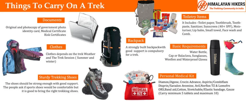
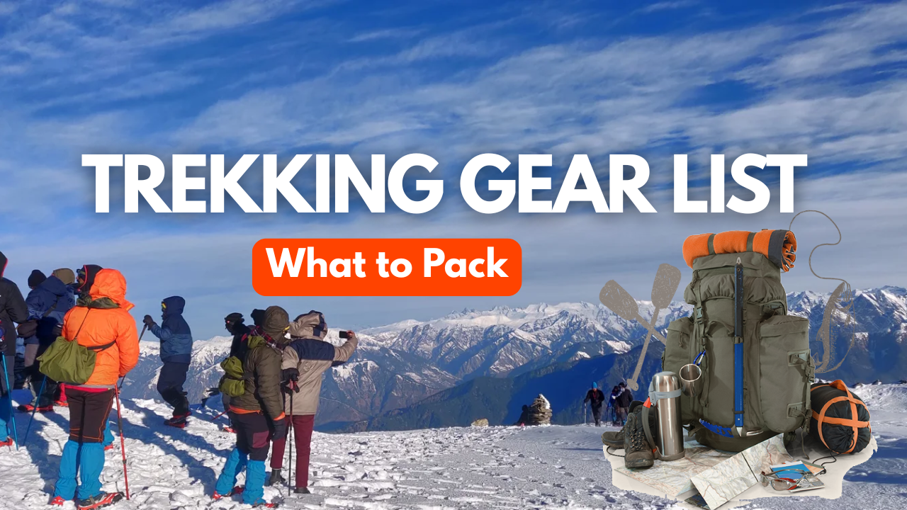
Essential Trek Gear List for the Valley of Flowers Trek
1. Trekking Gear & Bags
- Main Backpack (50–60 Liters): Must have a high-quality Rain Cover.
- Daypack (20 Liters): Mandatory. You will leave your main bag at the Ghangaria guesthouse and carry only essentials to the Valley.
- Trekking Poles: Essential for the steep stone-paved ascent to Hemkund Sahib.
2. Clothing (The Monsoon Layering System)
- Rainwear: A high-quality Poncho is better than a raincoat here, as it covers you and your backpack.
- Base Layer (2-3 Pairs): Quick-dry synthetic t-shirts. Avoid cotton as it won't dry in the humid monsoon air.
- Mid Layer: One light fleece jacket. It gets chilly at Ghangaria (base camp) at night.
- Outer Layer: A light windcheater or padded jacket for Hemkund Sahib ($4,329\text{m}$).
- Trekking Pants (2): Quick-dry, water-resistant material.
3. Footwear & Socks
- Trekking Boots: Waterproofing is non-negotiable. Ensure they have deep lugs (Grip) for slippery, wet stones.
- Floaters/Sandals: To wear at the guesthouse so your boots can dry.
- Socks: 4 pairs of synthetic/sports socks. Carry extra in case your feet get wet on the trail.
4. Headwear & Accessories
- Sun Cap: The mountain sun is harsh between rain showers.
- Woolen Cap: For the cold winds at Hemkund Sahib.
- Waterproof Gloves: One pair to keep hands dry and warm.
- Plastic Bags/Dry Bags: To double-wrap your electronics and spare clothes inside your bag.
Must-Have Medicines (VOF Edition)
- Knee Support/Braces: The descent from Hemkund Sahib is very steep and hard on the knees.
- Anti-Fungal Powder: Essential to prevent "trench foot" or fungal infections from wet feet.
- Pain Relief: Volini spray for calf muscles.
- Altitude Meds: Diamox (after consulting a doctor) for the steep climb to Hemkund Sahib.
- Digestive Care: Pudin Hara or Digene for stomach upsets.
Mandatory Document Checklist for VOF Trek
Note: Since VOF is in the same region as Kuari Pass, the forest permits are handled similarly by Himalayan Hikers in Ghangaria Check Post before entering valley of flowers Trek.
- Government ID Proof: Original + 2 Photocopies (Aadhar, Voter ID, or Passport).
- Trek Insurance: Mandatory for high-altitude trekking.
- Disclaimer Form: The standard indemnity bond provided by Himalayan Hikers at the base camp, Govindghat.
Quick Tips for Valley of Flowers
Start Early: Entry to the Valley opens at 7:00 AM. Starting early gives you more time to explore "Pushpawati River" banks before the afternoon rain clouds roll in.
Offloading: If you have back issues, you can hire a mule/porter from Govindghat to Ghangaria, but mules are not allowed inside the actual Valley of Flowers.
Mobile Network: Only BSNL and Jio work reliably in Ghangaria. Don't expect data; inform your family beforehand.
6-Week Plan specifically tailored for Himalayan Hikers requirements
1. Himalayan Hikers Fitness Benchmark: VOF & Hemkund
The climb to Hemkund Sahib is one of the steepest "pilgrim" trails in the Himalayas.
- The Benchmark: You must be able to cover 5 km in 30 to 32 minutes comfortably.
- The Endurance Goal: Since you will walk nearly 38–40 km over 4 days, leg endurance is more important than raw speed.
2. The 6-Week Training Schedule
Weeks 1-2: The "Foundation" Phase
- Running: 3 days a week. Focus on a steady 3 km jog.
- Strength:
- Squats: 3 sets of 20 (Total 60).
- Plank: 2 sets of 45 seconds.
- Step-ups: Step up/down for 5 minutes.
Himalayan Hikers Tip: Start increasing your daily water intake to 3 liters to prep your kidneys for altitude.
Weeks 3-4: The "Incline & Endurance" Phase
- Running: 4 days a week. Increase distance to 5 km.
- Strength:
- Walking Lunges: 3 sets of 20 reps. (Crucial for steep Hemkund stairs).
- Stair Climbing: Climb up and down 5 floors, 4 times.
- Calf Raises: 3 sets of 25. Prevents cramps during descents.
HH Gear Tip: Wear your trekking boots during morning walks once a week to avoid "shoe bites" at Ghangaria.
Weeks 5-6: The "Summit Ready" Phase
- Running: 5 days a week. Target: 5 km in 30-33 minutes.
- Strength:
- Stair Climbing with a Bag: Carry a 5kg backpack for 15 minutes.
- High Knees: 3 sets of 1 minute each for lung capacity.
- Mental Prep: Practice Pranayama for 10 minutes daily.
3. Exercise Breakdown for Valley of Flowers
| Exercise | Target Goal | Himalayan Hikers Logic |
|---|---|---|
| Jogging/Running | 5 km (32 mins) | Prepares lungs for thin air at Hemkund Sahib ($4,329\text{m}$) |
| Stair Climbing | 10-15 Floors | Mimics the 6 km steep ascent from Ghangaria. |
| Squats | 80 Reps | Essential for "braking" during steep descent. |
| Walking Lunges | 40 Reps total | Builds balance for slippery monsoon stones. |
| Planks | 90 Seconds | Helps carry daypack comfortably for 7-8 hours. |
4. Himalayan Hikers Key Points for VOF Fitness
- Ghangaria Checkpoint: This is your base camp ($3,048\text{m}$). The HH trek leads will check your oxygen level. High fitness leads to better oxygen saturation.
- Monsoon Humidity: Fitness helps your body regulate temperature when sweating under a poncho.
- Knee Care: Squats and lunges are your best insurance against "trekker’s knee."
- The Golden Rule: Insist on 4 liters of water daily to keep AMS at bay.
5. What to Present to the Himalayan Hikers Team?
- Fitness App Proof: 4-week history on Strava/Google Fit showing 5km runs.
- Medical Certificate: Signed by an MBBS doctor, within 15 days of the trek.
- Recovery Note: If you can run 5km today and feel fresh tomorrow, you are "Trek-Fit".
Note: This is a suggestion to help your trek, but you can prepare according to your own fitness preferences.
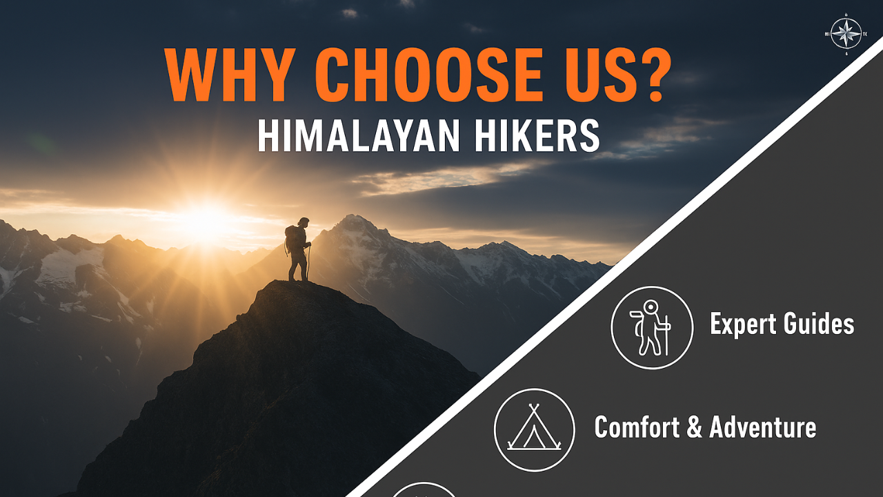
Why Himalayan Hikers is the Safest Choice for the Valley of Flowers Trek
At Himalayan Hikers, we don't just lead treks, we share our home. With over 35 years of experience and our deep roots in the Garhwal region (Joshimath and Govindghat), we provide a level of security and local expertise that is unmatched in the Valley of Flowers.
1. Elite Safety & Expertise
- NIM Certified Leaders: Our trek leaders are graduates of the Nehru Institute of Mountaineering (NIM). IMF – Indian mountaineering foundation They are experts in monsoon safety, slippery terrain management, and Wilderness First Aid.
- Twice-Daily Health Checks: Even though VOF is a "moderate" trek, altitude is real. We use Oximeters and BP Monitors every morning and evening to track your acclimatization.
- Medical Backup: Every group is equipped with Portable Oxygen Cylinders and a specialized medical kit tailored for monsoon-related issues and high-altitude sickness (AMS).
- Specialized Monsoon Gear: We provide guidance and high-quality equipment to ensure you stay dry and safe on the wet stone trails of Hemkund Sahib.
2. Premium Accommodation (Guesthouse)
- Comfortable Stays in Ghangaria: VOF requires staying in Ghangaria. We provide the best-in-class guesthouses/hotels with clean beds and attached washrooms to ensure you recover well after long walks.
- Joshimath/Govindghat Hospitality: We ensure premium hotel stays at the base to give you a restful start and end to your journey.
- Hygiene Standards: Our staff ensures that your rooms are sanitized and your bedding is dry and fresh, despite the high humidity of the monsoon.
3. Reliable Transport & Local Logistics
- Expert Mountain Drivers: The road from Haridwar via /Rishikesh to Govindghat can be tricky during the monsoon. Our drivers are local experts trained for landslide-prone zones and heavy rain conditions.
- Fleet Excellence: We use well-maintained Tempo Travelers, Ertigas, to ensure your 10-hour journey is comfortable and safe.
- Seamless Transfers: From Dehradun pickup to the Govindghat/Pulna trailhead, Himalayan Hikers manage every mile of your transport.
4. Nutritious "Trek-Fuel" Meals
- Balanced Diet: We serve four fresh, hot meals daily (Vegetarian, Jain, and Egg options). Our menu includes Indian, Chinese, and Continental dishes designed to provide high energy for the steep climb to Hemkund Sahib.
- Hydration & Hygiene: We provide boiled and filtered drinking water at all stages. We also serve specialized soups and herbal teas to keep your immunity high in the rainy weather.
Enhanced Safety Measures (Valley of Flowers Edition)
| Safety Feature | Benefit to the Trekker | The Himalayan Hikers Edge |
|---|---|---|
| Monsoon Protocols | Prevents slips on wet, stone-paved paths. | Guides provide technical "wet-weather" walking tips and trekking pole assistance. |
| Radio/Satellite Comm | Essential in the "Blackout Zone" of Ghangaria. | Our team uses high-frequency Walkie-Talkies to connect the trail with the base camp. |
| Evacuation Ready | Rapid response for injuries or AMS. | We have a dedicated network of mules and local porters on standby for immediate descent to the Govindghat hospital. |
| Eco-Heritage Focus | Keeps the UNESCO World Heritage site clean. | We follow a strict "Pack it in, Pack it out" policy to preserve the flora for future generations. |
The Himalayan Hikers Promise: Because we belong to these mountains, we know every shortcut, every weather pattern, and every local medical facility. You aren't just a client; you are a guest in our valley.
Join Himalayan Hikers enjoy your trek with safest trekking team
| Category | Details |
|---|---|
| Transport | Dehradun to Dehradun round-trip via Tempo Traveler (Pickup & Drop) Rishikesh to Rishikesh round-trip via Tempo Traveler (Pickup & Drop) |
| Permits & Entry | Forest Permit and Entrance Fees |
| Accommodation | Hotel in Govind ghat & Ghangaria Accommodation on quad sharing |
| Meals | Breakfast, Lunch, Tea, Coffee, Snacks, Soup, Dinner (All meals included) |
| Support Staff | Kitchen Team, Trek Helpers |
| Communication Tools | Radio Walkie-Talkie |
| Trek Guides | Experienced Trek Leader & Technical Guide |
| Safety Equipment | Medical Kit, Oxygen Cylinders, Pulse Oximeter |
| Category | Details |
|---|---|
| Meals (Not Included) | – Day 1: En route Breakfast & Lunch to base camp– Day 6: En route Lunch & Dinner (not included) |
| Insurance & Documents | – Personal Insurance– Medical Certificate (Mandatory) |
| Personal Essentials | – Personal Toiletry Items– Personal Medical Kit |
| Porter Service | – The porter fee for the entire trek is ₹1600.(Pulna to Ghangaria & Ghangaria to Pulna) (to be paid directly at Govindghat base camp)– Minimum bag weight for porter: 8 kg |
| Foreign Nationals | – ₹1600 extra for trekking permit– Passport and valid Visa required |
Important Note
Himalayan Hikers offers both online and offline booking options for their treks. Here’s a breakdown of both options:
1. Online Booking:
- Website: Himalayan Hikers has an official website where trekkers can browse through different treks, check details (itineraries, costs, difficulty level, etc.), and make bookings. Payment gateways are integrated for secure online transactions.
- Third-Party Platforms: They might also be listed on various trekking or adventure booking platforms, where you can compare prices, read reviews, and make bookings.
- Email Communication: Trekkers can inquire about treks via email and complete the booking process online, following email communication and payment.
2. Offline Booking:
- Direct Office Visit: Himalayan Hikers has physical offices (especially in Uttarakhand), where trekkers can visit in person, discuss treks, and complete bookings directly.
- Phone Booking: You can also call their office to make a booking. Details about payment methods, trek dates, and other logistics can be confirmed over the phone.
Yes, Himalayan Hikers requires a 25% advance payment for booking treks, Via- Google pay or UPI, Directly Himalayan Hikers Account with the remaining amount to be paid in cash at their branch office in Govindghat before the trek starts.

The Valley of Flowers Trek is a famous trek in the Indian Himalayas, known for its stunning meadows filled with a diverse array of flora. It is part of the Nanda Devi Biosphere Reserve and is a UNESCO World Heritage Site.
The Valley of Flowers is located in the Chamoli district of Uttarakhand, India, within the Nanda Devi National Park.
The trek starts from a village called Govindghat. Here’s how you can reach Govindghat:
- By Air: The nearest airport is Jolly Grant Airport in Dehradun, about 292 km from Govindghat. From there, you can hire a taxi to Govindghat.
- By Train: The nearest railway station is Rishikesh Railway Station, around 273 km from Govindghat. You can take a bus or taxi from Rishikesh to Govindghat.
- By Road: Govindghat is well-connected by road. You can take a bus or taxi from Dehradun, Haridwar, or Rishikesh, which is approximately a 10-12 hour drive.
The best time to visit the Valley of Flowers is during the monsoon season, from mid-July to early September. This is when the valley is in full bloom with a variety of flowers.
The Valley of Flowers trek typically takes 6-7 days, including travel time to and from Govindghat.
The trek is considered moderate. It involves gradual ascents and descents, and the trail is well-defined. It is suitable for trekkers with a reasonable level of physical fitness.
The Valley of Flowers is situated at an altitude of approximately 3,658 meters (12,000 feet).
Here’s a list of essential items to pack:
- Warm clothing (layers, thermal wear, fleece jacket)
- Waterproof jacket and pants
- Trekking shoes with good grip
- Trekking poles
- Backpack (40-60 liters)
- Sleeping bag (if not provided by the trekking company)
- Personal medical kit
- Water bottles and purification tablets
- Snacks and energy bars
- Raincoat/poncho
- Sunscreen, sunglasses, hat
- Flashlight/headlamp with extra batteries
- Toiletries and personal hygiene items
Yes, you need permits to enter the Valley of Flowers National Park. These can be obtained from the forest department office in Ghangaria, the base camp for the trek.
Accommodation during the trek typically includes guesthouses in Govindghat and Ghangaria. The facilities are basic but comfortable.
The trek involves challenges such as:
- Changing weather conditions
- Physical strain from trekking
- Altitude-related issues It’s essential to acclimatize properly, stay hydrated, and follow the guidance of your trek leader.
While it is possible to trek alone, it is highly recommended to join a group or hire a local guide for safety, navigation, and a richer experience.
Yes, beginners can do the Valley of Flowers trek, but it is advisable to be in good physical condition and perhaps undertake some shorter treks beforehand to build endurance.
Most trekking packages include vegetarian meals, which are nutritious and catered to trekking needs. The food usually includes local cuisine, rice, chapati, vegetables, dal, and snacks.
Spectacular meadows filled with vibrant flowers Views of snow-capped peaks The serene Hemkund Sahib, a high-altitude Sikh Gurudwara and lake Rich biodiversity, including various species of butterflies and birds
The trek includes a visit to Hemkund Sahib, a significant pilgrimage site for Sikhs. The region also reflects the local culture of the Garhwali people.
A basic level of fitness is required for the Valley of Flowers trek. Regular cardiovascular exercise, such as jogging, swimming, or cycling, and leg strengthening exercises can help prepare for the trek.
Altitude sickness can affect anyone above 2,500 meters. To minimize the risk:
- Acclimatize properly
- Stay hydrated
- Avoid alcohol and smoking
- Ascend slowly and give your body time to adjust
.png)


.png)
.png)

.webp)